All artworks by Olivier Edelin
Toile d'araignée • 7 artworks
View all
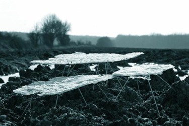
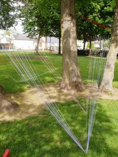
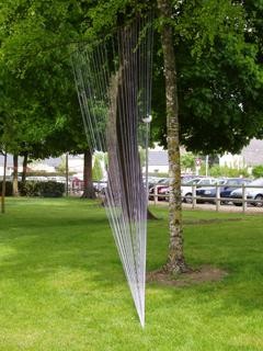
Lors du festival organisé par l'association ELAN en Bretagne, un dialogue c'est instauré entre les arbres,[...]
Lors du festival organisé par l'association ELAN en Bretagne, un dialogue c'est instauré entre les arbres, les champs et les arachnides.


Latitude Longitude-Collège Guteberg de Malesherbes • 11 artworks
View all
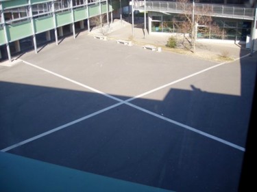
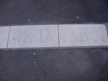
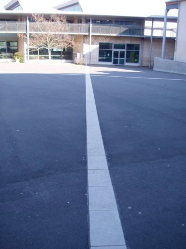
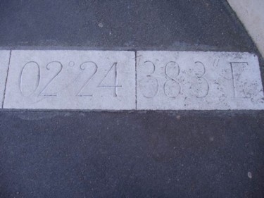
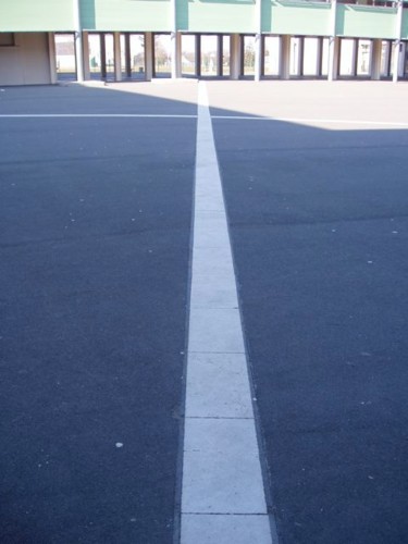
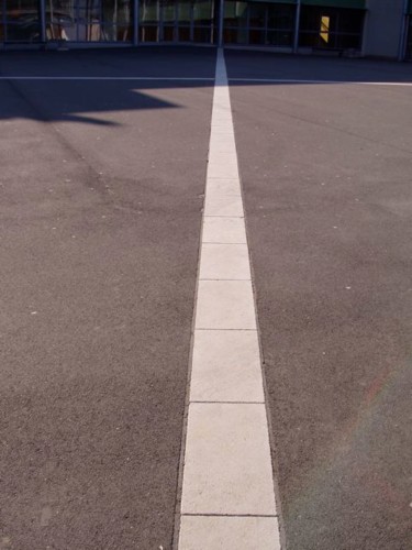
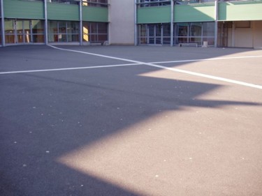
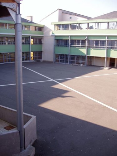
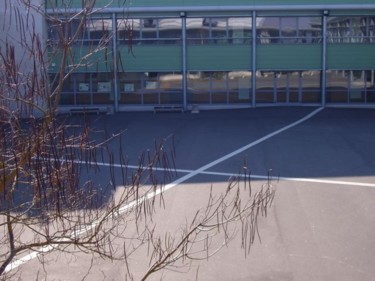
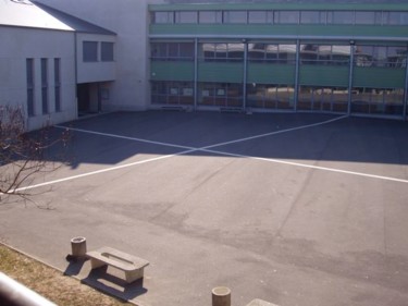
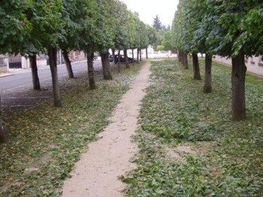
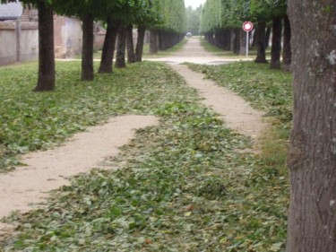
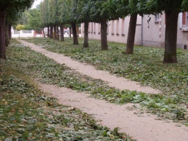
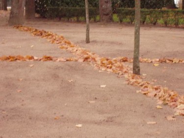
Au coeur de la cour du collège Gutenberg de Malesherbes (Loiret), deux lignes blanches viennent matérialiser[...]
Au coeur de la cour du collège Gutenberg de Malesherbes (Loiret), deux lignes blanches viennent matérialiser une couple de latitude et de longitude. Comme un affleurement du sous-sol, le calcaire utiliser marque la cour de récréation et offre aux élèves un point de repère aux élèves.

La ligne verte • 5 artworks
View all
Une taille sévère en été et l'automne est là en monochrome vert


Latitude Longitude • 5 artworks
View all
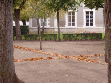
Où est-on ? Question existentielle pour l’homme. Depuis toujours l’homme cherche à maîtriser son environnement.[...]
Où est-on ? Question existentielle pour l’homme. Depuis toujours l’homme cherche à maîtriser son environnement. Ainsi très vite il a cherché à se repérer dans le temps. Pour cela il a conçu et fabriqué des calendriers lunaires, solaires. L’horlogerie s’est développée et continue de se perfectionner avec les horloges atomiques ou cosmiques pour atteindre une précision impalpable à l’échelle humaine.
De la même façon, l’homme cherche à se localiser dans le monde qui l’accueille. Localisation qui lui permet de se mouvoir, de se déplacer avec précision. Ainsi rapidement des cartes ont été levées. Puis ces espaces cartographiés ont été découpés en éléments toujours plus petits et donc précis : comme pour le temps.
Cette obsession de la localisation, de la maîtrise de son environnement peut être analysée comme le reflet d’une nécessité de sécurité. Car quoi de plus angoissant que de se penser perdu.
Mais a-t-on vraiment conscience de notre localisation ? La connaissance de notre position très précise est-elle vraiment informative ? Ici je suis là, mais après un pas de côté ? Où suis-je ?
Pour répondre à ce besoin de localisation l’homme a développé des outils intellectuels. Les cartes sont ainsi cadriées de lignes droites qui renvoient à des valeurs numériques. Ces droites n’existant que pour l’homme sont les latitudes et les longitudes .
Ces lignes qui forment un repère orthonormé nous permettent donc de se repérer sur Terre d’une façon sûre, scientifique. Mais ceci reste abstrait. Qui sait où passe précisément la latitude et la longitude la plus proche. Raisonnement ridicule, car ces lignes virtuelles sont infinies, il y a autant de couple (latitude-longitude) que de position possible sur Terre.
D’où le problème : même si je connais ma position exacte, où suis-je vraiment? Aussi si des latitudes et des longitudes sont tracées au sol et donc matérialisées, que signifient-t-elles ? Je peux décider d’en suivre une, marcher dessus tel un funambule. Je peux également franchir cette ligne et passer dans une autre zone de la Terre, un monde différent ?
Alors cette localisation si précise et si visible, permet-elle réellement de mieux se situer dans le monde ?
Ou permet-elle seulement de reposer toujours le problème :
Où suis-je ?


Travaux automne hiver 2004 • 8 artworks
View all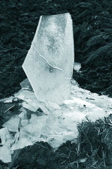
Traits de lumières. • 10 artworks
View all
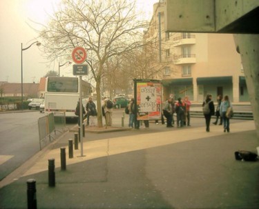
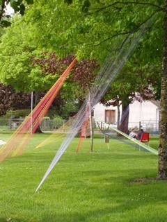
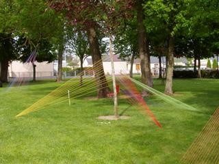
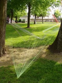
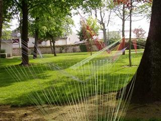
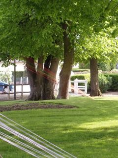
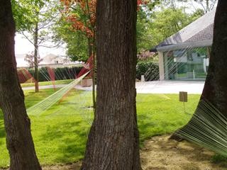
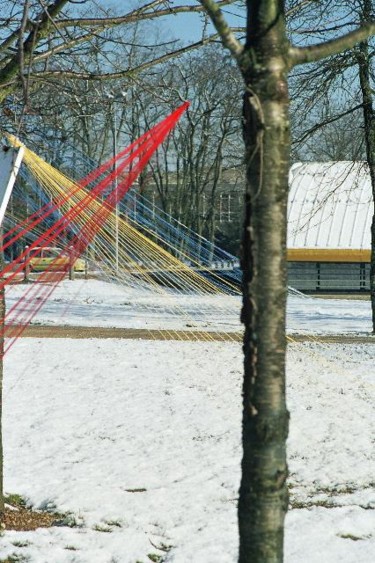
Un petit parc de salle des fêtes dans le quel joue la lumière avec des harpes de couleur, comme autant[...]
Un petit parc de salle des fêtes dans le quel joue la lumière avec des harpes de couleur, comme autant de "traits de lumière".
Travaux des champs • 10 artworks
View all
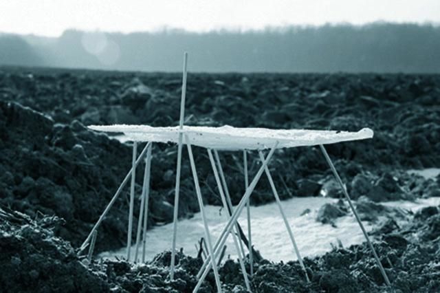
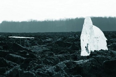
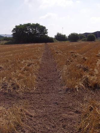
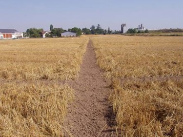
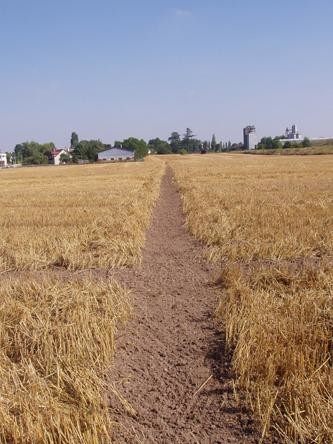
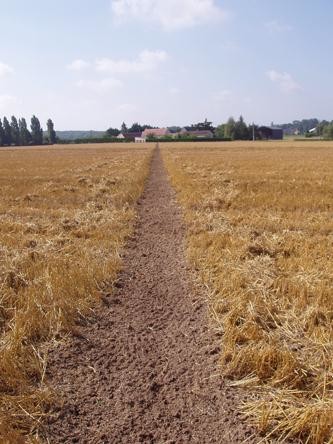
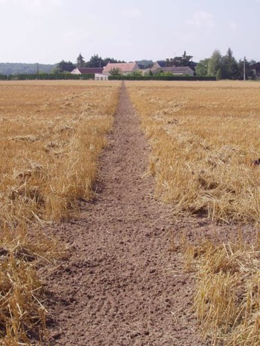
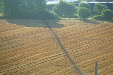
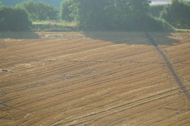
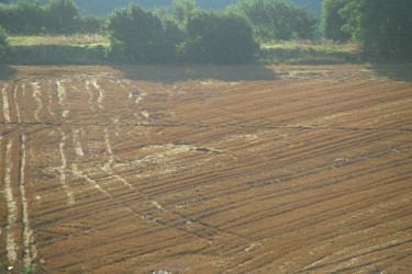
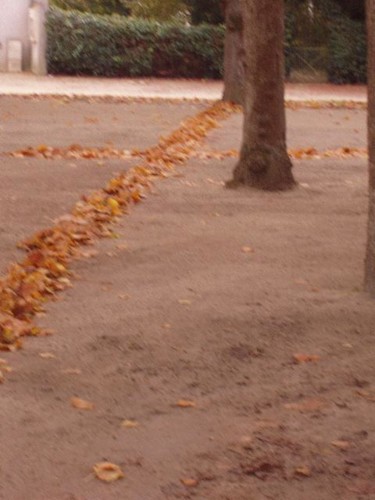
Tous les été le même spectacle se reproduit. Les blés ondulants sous le vent sont moissonnés pour ne[...]
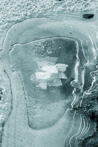
Tous les été le même spectacle se reproduit. Les blés ondulants sous le vent sont moissonnés pour ne laisser qu"un champ de chaumes. Cette installation rend hommage aux travaux des champs, car tout fût réalisé à la main. Et interroge une problématique plus abstraite, sur le positionnement de l"homme dans son monde. En effet ces deux saignées sont un couple de latitude et de longitude.
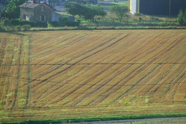
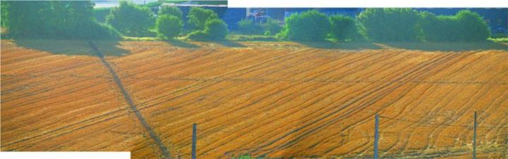
Latitude longitude à Neuville aux bois. • 10 artworks
View all
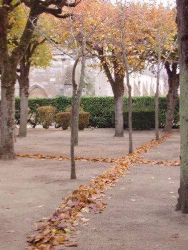
Troisième volet de la matérialisation de la problématique du positionnement et de sa signification pour l"homme.


Lignes d'automne. • 10 artworks
View all
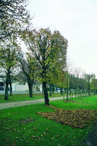
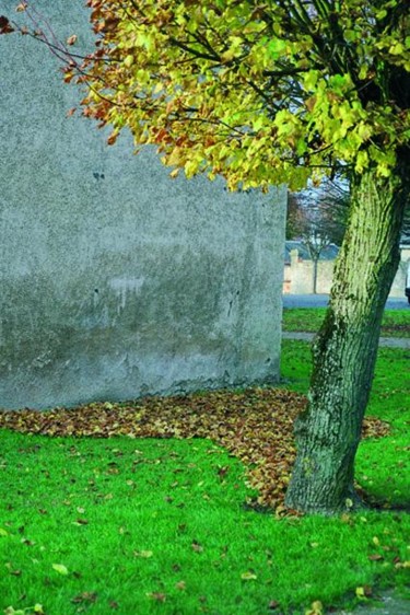
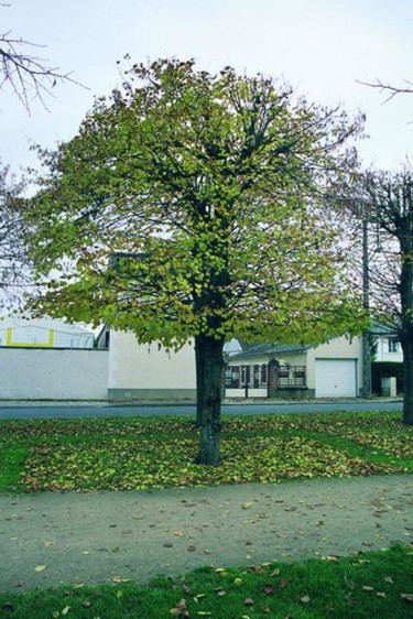
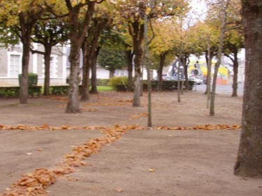
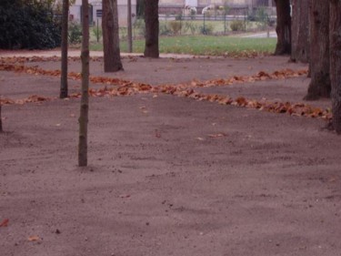
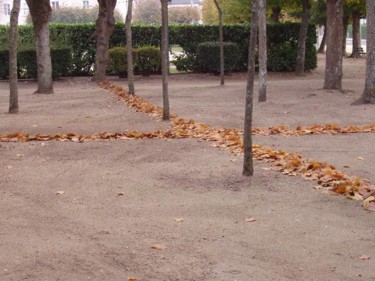
A l"époque où les feuilles mortes tombent, j"ai pris mon rateau pour rendre visible quelques un des[...]
A l"époque où les feuilles mortes tombent, j"ai pris mon rateau pour rendre visible quelques un des motifs cachés dans cet ammoncellement.


Cônes, Traits de lumière et moisson d'hiver. • 10 artworks
View all
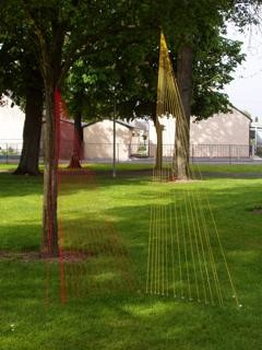
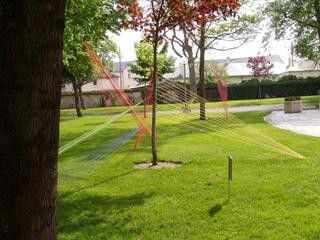
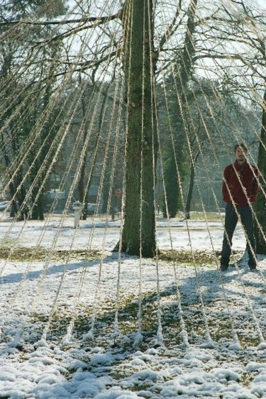
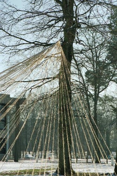
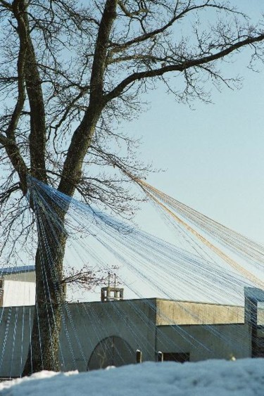
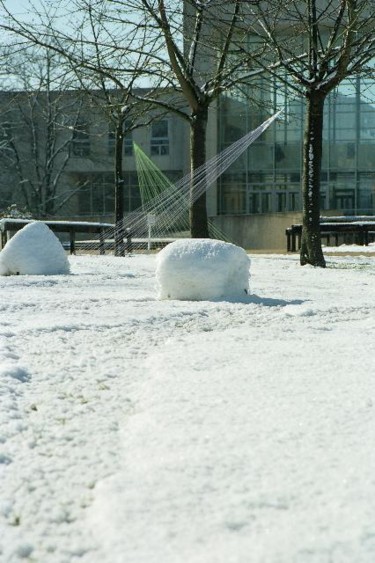
Le campus de l"université d"Orléans est un lieu minéral, végétal et ouvert. Pour les portes ouvertes,[...]
Le campus de l"université d"Orléans est un lieu minéral, végétal et ouvert. Pour les portes ouvertes, une installation à base de fil de couleur a été réalisé. Jouant avec les arbres et la perspective du lieu, des éléments colorés se forment et disparaissent selon la d"éambulation du promeneur.
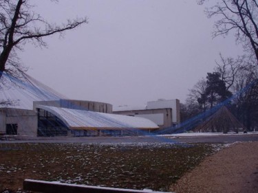
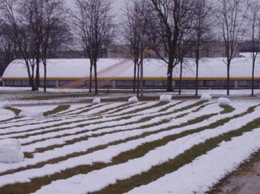
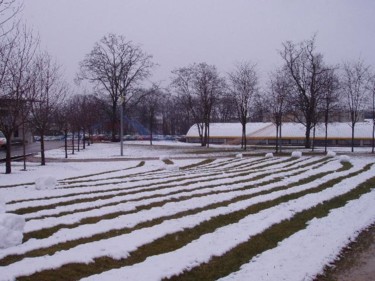
Cette année le mois de mars fut neigeux. Et j"ai aussi moissoné la neige pour la mettre en balle, traçant une alternance de ligne blanche et verte. Petit clin d"oeil à Mr Buren.
Cette année le mois de mars fut neigeux. Et j"ai aussi moissoné la neige pour la mettre en balle, traçant une alternance de ligne blanche et verte. Petit clin d"oeil à Mr Buren.


Recognition
No data available yet
Biography
Originaire de l'anjou, j'ai remonté la Loire pour poursuivre mes études.
Scientifique de formation, je suis titulaire d'une maitrise de biologie et de géologie.
Ma pratique artistique est entièrement autodidacte. Un réel travail avec une production est présente depuis 2004.
Je vis et travaille actuellement dans le loiret.
-
Nationality:
FRANCE

- Date of birth : 1977
- Artistic domains:
- Groups: Contemporary French Artists
Influences
No data available yet
Education
No data available yet
Artist value certified
No data available yet
Achievements
No data available yet
Activity on Artmajeur
Last modification date : Feb 23, 2013
(Member since 2005)
Image views: 31,925
Artworks by Olivier Edelin added to favorite collections: 0
Latest News
All the latest news from contemporary artist Olivier Edelin
Added May 6, 2005
Article
Originaire de l'anjou, j'ai remonté la Loire pour poursuivre mes études.
Scientifique de formation, je suis titulaire d'une maitrise de biologie et de géologie.
Ma pratique artistique est entièrement autodidacte. Un réel travail avec une production est présente depuis 2004.
Je vis et travaille actuellement dans le loiret.
Added May 6, 2005
Article
L’utilisation et l’intervention des artistes dans le milieu naturel a donné naissance au Land Art1. Je m’inscris dans cette démarche dans laquelle notre environnement devient le support de l’expression artistique. L’œuvre, le plus souvent éphémère est donc évolutive avec son support qui se modifie dans le temps : modification qui fait partie intégrante de l’œuvre.
Ainsi de cette volonté d’interagir avec le milieu, la question du positionnement de l’homme dans son environnement s’est posée.
Added May 6, 2005
Article
Pour le moment c'est avant tout mon esprit et la réflexion qui s'y développe. Par la suite les réalisation sont directement réalisée in situ et donc l'espace investit me sert d'atelier.
Added May 6, 2005
Expos Solo (Listing)
#1-31 mars 2005 Campus de l'université d'Orléans la Source : "Latitude-Longitude"
#29-30 avril et 1 mai Festival de Neuville aux arts :"Traits de lumière"
Reviews and comments

Chouette !
Enfin quelqu'un qui annonce Land Art et le pratique effectivement !
Bonne continuation !
Y-
Bravo l'artiste... Je te souhaite une vie remplie de rêves et l'envie furieuse d'en réaliser quelques uns... Entre la passion de l'art pour l'art et les occupations de la vie de famille,volà ta vie bien remplie... Les photos sont très belles, sobres, originales...Continues!
Contact Olivier Edelin
Send a private message to Olivier Edelin